

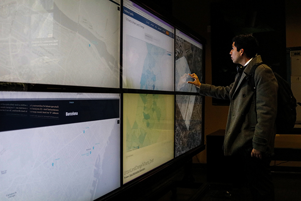
The University celebrated Geographic Information System Day on Wednesday by educating faculty and students about the growing field of research during several events across campus.
The field captures and stores data about specific positions on Earth’s surface, according to a UT Libraries press release. Geospatial data contains both location information as well as information about what is going on in that location, geospatial data coordinator Michael Shensky said. Events included a panel discussion about the future of the field and a demonstration about what the technology can do.
Geographic information system analyst Zachary Berry said the system offers people access to information ranging from a building’s height and size to its material and builder. He said the field is broadly applicable to many industries.
“A lot of different industries, the information that they are collecting also has a spatial component to it,” Berry said. “You’re taking everything in the world that has a spatial location … and then assigning all different kinds of information to each of those things individually.”
In conjunction with the event, Texas Libraries launched the Texas GeoData Portal, which will provide geospatial data for anyone to use for mapmaking. Shensky said professionals in fields such as history or architecture can use the information in the portal for their own work, such as studying historic trade routes or observing landscape designs. He said as the amount of datasets increase, the portal will be able to serve a wider population.
“I think it will be this snowball effect where it (has) wider usage,” Shensky said. “What we would like to see overtime is researchers incorporating that information into their work, students using it in class projects and faculty and staff researchers using it to gain new insight into what they are working on.”
Sue Stewart, senior information technology manager for the University, said taking foundational courses is a good way for students to learn some of the skills needed to use the system. She said students who study it should develop the ability to find and transform spatial data.
“Data transformation skills will be very critical for success of GIS students in the future,” Stewart said. “There is a ton of resources out there in terms of spatial data, shape files, things that have coordinates on them that are maybe in an Excel spreadsheet but need to be transformed into spatial data.”