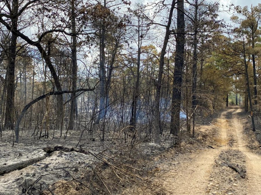
UT-Austin’s Stengl Lost Pines fire causes destruction but creates research opportunity
September 15, 2022
A fire last month at UT’s Stengl Lost Pines Biological Station provided researchers with a unique opportunity to study how environments recover from fires.
Located 40 miles east of Austin, the Stengl Lost Pines region is an isolated part of the westernmost extent of a southeastern pine forest system, station director Lawrence Gilbert said.
“It’s not just the Lost Pines, it’s a lost ecosystem,” Gilbert said. “This gives us a very different kind of ecoregion to study near Austin, and it’s in great contrast to the other (field research) sites that we have.”
Site manager Steven Gibson said the isolated nature of the habitat makes it easier to observe the impacts of small changes on an ecosystem in a region that is easily accessible to UT students and researchers.
“We can conduct research at these field stations, which reflects the broader issues and changes which occur in Central Texas,” said Robert Plowes, research scientist at the station.
Gilbert said that over 300 acres of the habitat were affected by the Pine Pond Fire, which started on Aug. 11 and was fully contained over a week later. The intensity of the fire varied, leaving some regions of the habitat virtually unscathed but others severely damaged. Gilbert said the cause of the fire is still under investigation.
The fire also jeopardized species distinct to the region, such as flying squirrels, who survived larger fires in years prior and were put at risk in this most recent blaze, Gilbert said.
“Depending on how many little patches of forest survived and what the conditions were in there, we may or may not still have our flying squirrel population,” Gilbert said. “There are a number of really interesting plants and animals that are characteristic of that little habitat and nowhere else in Central Texas.”
A vast transectional trail mapping system of the area provided researchers with reference to their exact positions on the trails but was then destroyed in the fire, Gilbert said. The researchers lost built-up knowledge of the region and the life within, Gibson said.
“We’ve spent the better part of the last three decades mapping these systems,” Gibson said. “We had a really good idea of what types of organisms existed in which areas on the field stations and that’s the work that we’re going to have to redo.”
Although the fire caused a lot of damage, the recovery process will provide researchers with a valuable opportunity to observe how forests recover after an ecological disaster, Gilbert said.
“We’re going to be very carefully managing and monitoring to see what the different parts of recovery will be,” Plowes said. “There is an opportunity to do some interesting research there.”
Plowes said this recovery process will allow researchers to predict how other parts of the region would respond after a fire. He said these predictions are aided by the vast amount of information that was collected about the forest’s prior condition, which is often an area of interest when observing recovery processes.
“There are a number of ecological questions that can be studied now that the fire has happened,” Gilbert said. “We wouldn’t have wished for it, but now that we have it, we have to make the best of what we have.”