Tucked between tourist central Grand Cayman and less known Cayman Brac lies Little Cayman, which serves as a tropical record of the past, said Scarlette Hsia, geoscience graduate student. While the island is only 10 square miles, it can expose millions of years of geological history.
Hsia aimed to map out the geology of the island in order to understand landform patterns and how they signal climate changes.
Hsia said creativity plays a large role in geology.
“It’s sort of like you’re solving a mystery,” Hsia said. “There’s something that’s going on … the evidence is right before your eyes but putting the story together can be pretty challenging.”
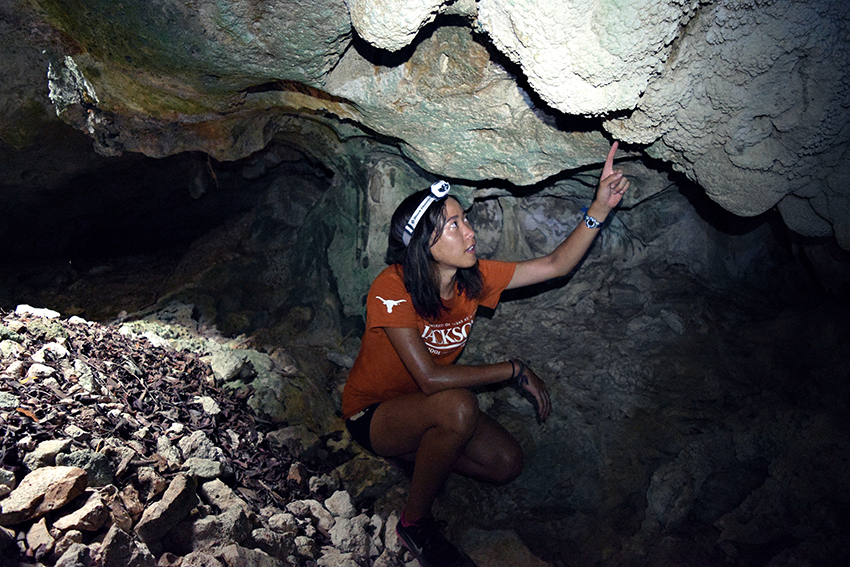
Hsia utilized that creativity to study sinkholes, caves and rock layers of Little Cayman to understand the formation of the island, as well as how it approaches practical problems such as construction and providing fresh water for residents.
In 2016, Hsia studied at the Jackson School of Geosciences and surveyed Little Cayman for eight weeks through the National Science Foundation’s branch program, Research Experiences for Undergraduates. Hsia produced a geologic map that charts the differentiation between rock ages.
With the help of technological advances, Hsia was able to construct a detailed and useful understanding of the island.
The topography of Little Cayman is scattered with clues to the island’s formation, climate and sea level changes. The island is made up of limestone that dissolves in water and erodes over time to form what is known in the geology world as karst features, according to National Geographic.
By cataloging the karst features of the island, Hsia was able to document the changes of the island in different periods of time to help understand sea level changes.
“Past sea level signals can serve as an analog to (the) present and also help us with understanding changes that might occur in the future,” Hsia said.
While on Little Cayman, Hsia located, mapped and named two caves on the island, using two friends to carry out traditional cave mapping with just a tape measure and a notebook.
“One person is sort of the artist and they sit down and they’re sketching out the cave while the other two are picking arbitrary points around the cave,” Hsia said.
Those arbitrary points and the artist’s sketch combine to form a spatial map of the cave.
By the time her eight weeks came to an end, Hsia had produced the two cave maps along with a karst inventory map, serving as a tool for future development, construction and planning for the island, Hsia said.
Hsia’s plans for graduate thesis research will continue with differentiating rock ages of carbonate islands, this time off the coast of the Bahamas, a project that requires a scuba suit and a creative mindset.
“The challenge with the project itself is that 80,000 years ago the average global mean sea level was eight meters below where it is now, so any sort of paleo-shoreline indicator that I would be looking for would be underwater,” Hsia said.
Although difficult, this project is a welcome challenge to Hsia, who earned her certification as a PADI Divemaster, to tackle geological questions that remain unanswered.
“When you realize that there are multiple ways to solve a problem, a world of possibilities opens up,” Hsia said.


